Today I was running late so I had to pick a trail that wouldnt take too long. And since I wanted to work on my video clips of each of the trails I've hike, Mariners ridge worked out perfectly.
Its a pretty short hike, just under 3 miles for the round trip and not that much climbing involved. Maybe 1,000 feet total.
This is the hike I usually take newbie hikers on to get a taste of hiking. Mariners Ridge has the highest "bang for the buck" out of almost any hike on Oahu. The view at the top is as good as some 5 mile hikes!!
First shot is the start of the trail. You park pretty close to the start of the trail and just go for it!! Only real word of caution is watch of for the many doggie land mines! Lots of dogs on this trail and lots of uncaring owners who dont pick up afterwards!
Beginning part of the hike there is almost no cover so try not to go noon unless you have a hat and water!! But cool breezes are always blowing off the mountains so its not as hot as most hikes.
Restoration area? doesnt look like they doing good job! j/k and secret about this spot is there is a geocache really closeby!!
Along the way you will see lotsa photo opportunities to get some nice shots of Hawaii Kai and Koko Crater.
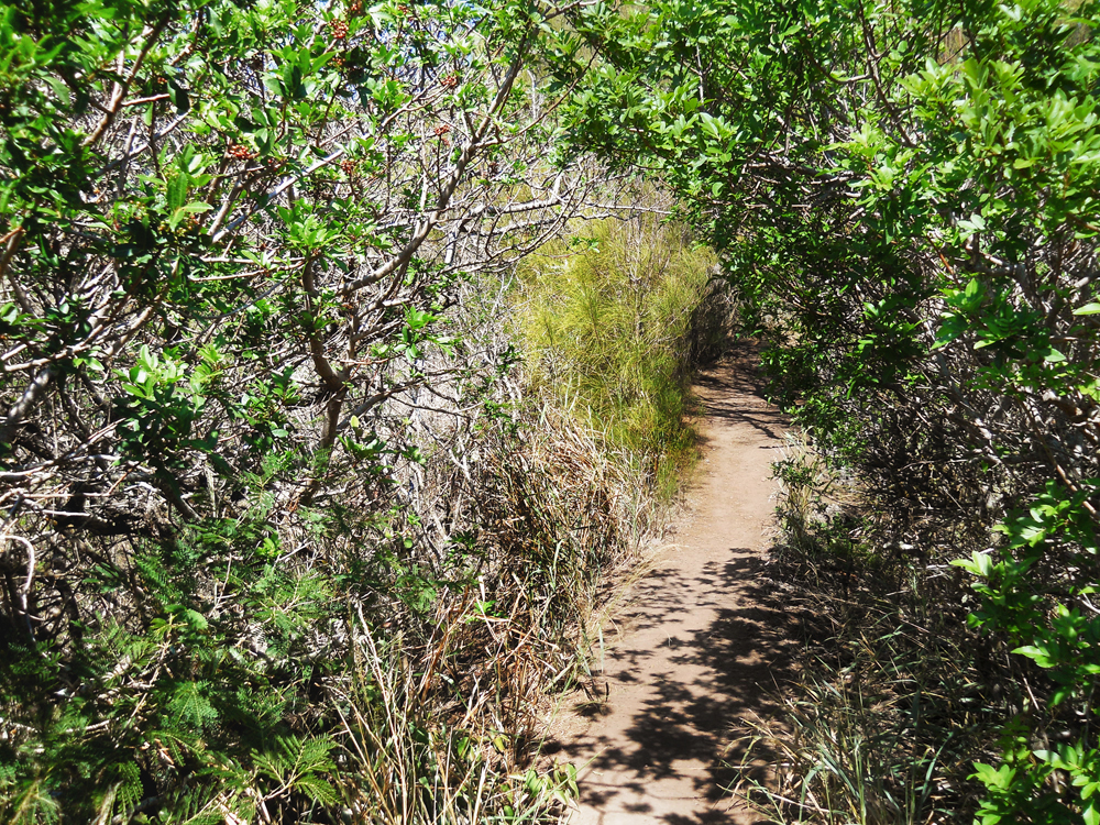
Almost making it to the tree sections and some shade. I doubt its possible to get lost on Mariners Ridge, they trail is so well marked its like a road!
Another view of Koko Crater. If you want a better shot, just climb up that short hill to the right.
And finally made it to the forest section of the trail. From here on you are mostly in some shade. I love hikes that have all kinds of ecosystems? terrains?
And our goal is in sight!! For most hikes, the target you are aiming for sticks out like a sore thumb but Mariners Ridge, you really don't see any target to aim for...
And more trees to pass thru. Trail is almost always nice and dry. I cant remember ever seeing any mud on this hike. No really hard steep climbs either. And no dangerous spots with death defying drop offs (except at the summit).
And getting closer to the top. Trail pretty much looks like this almost all the way to the top.
And here's the view at the top! Didnt I tell you the view is way out of proportion from the amount of work getting here? Awesome hike for whole family. There are 2 "lookout" parts at the top. One you have to climb up some rocks to get to and the other just follows the trail till it comes to and end. But the drop offs are awesome on both! Seems like the thing just goes straight down!!
View of the Waimanalo coast and Kailua.
And here's the half way stats: 1.32 miles with 954 feet in climbing. Almost as much climbing as Koko Crater with half the energy spent! Took me less then hour to get up here but I was doing lots of picture taking and video making (yeah, thats my excuse).
And since it was still early, this is the next part of my hike. But instead of going over the top and climb down the rocks, I took the "new" trail that leads to here. Just head back down the trail until you come to a fork that runs west. Just follow it ...
Some parts are narrow but nothing dangerous. Way easier going this way then climbing down those rocks.
See, I'm at the bottom already. Now just follow the trail for another awesome view of Waimanaolo and more!
Nice bit of shade that went around a rock section. Some parts of this trail are pretty slippery. Only loose dirt that doesnt really pack well so you just slide! So, be careful not to fall!
You even get a nice view of Hawaii Kai? no.. Hahaione? Forgot where but nice view anyhow..
And now heading back, I decided to go up the rock section. It's way easier climbing up rocks the down them. And this one isnt hard at all. Lots of handholds and flat sections so you can almost walk up the whole thing.
And here's my final tally for the whole trip. Just bit over 3 miles in distance and only 1,264 feet in climbing. Pretty easy hike if you ask me!
No work again on a thursday (slow month) so off to try something different. Was thinking maybe Hahaione, Mariners ridge or Kamiloiki since it was such a nice day. Finally the vog and Kona winds seemed to have left us...
Since havent been there in while and it is a pretty easy trail, Kamiloiki won! Hopped in my car, hit 7-11 for a sandwich and super big gulp (my energy drink!) and off I went.
(insert picture of Heiau here)
lol somehow forgot to get good shot of the Pahua Heiau (having fun trying to do gopro video again).
View along the trail of the farms in that valley. I never noticed that this trail is like a mini Lanipo! Up and down hills the whole way. But, unlike Lanipo, the hills are a lot smaller so no way as hard!!
View of the other valley with Hawaii Kai and Koko Crater in background. It was a great day with light breezes and lotsa clouds. Thats only way to do a ridge hike, make sure u go early or pick a day with lotsa clouds.
As you can tell, there is NO shade on this hike! Be good idea to wear hat or carry umbrella?
finally had a bit of shade that lasted for like 5 minutes. All the endless hills really suck you dry, so carry a lot of water too!
As you can tell, the scenery doesnt change much. Just up and down u go with no shade!
And finally made it to the trees!! Once u reach here u are pretty much almost done with the hike. The shade really felt great and there is even a small camping site over here.
There is a short, grassy section with a power line pole right in the middle of the forest. Its not that big so nice change of pace.
And this section (if you finally reached it) is the final drive to the top!! The hike to the top is tame compared to almost every trail on the Koolaus! Not kidding, just a small hill and u up to the top.
Tadaa!! what an awesome view of Waimanalo and etc. But this shot is a bit up the trail towards Kailua direction.
Couple shots more of the scenery. You get nice view of Olomana too.
Saw another set of poles near the summit. I was below them exploring on a side trail.
And another view from direction I came from. Right about here I was looking for a geocache and noticed a trail heading towards Hawaii Kai. Thought it might run along the ridge west of Kamiloiki ridge so I wanted to see! After following a bunch of ribbons, the trail started to go downwards into the valley between the two ridges. I didnt wanna be stuck down there with a long long walk in a pretty thick looking forest with no way back up to my car! I turned around to go back up to the top and just my luck, the ribbons disappeared! Guess you can only see them from the ridge looking towards Hawaii kai, not the other direction.
This is what it looked like whole way. Thick, dead grass! Looks easy to walk thru but it isnt. That stuff just grabs your legs and slowly sucks away your energy pushing thru it! Every once in while id see a ribbon or two but no trail. Got to a spot where I saw some old soda cans and figured I must be close to the trail. So I climbed up the side of the ridge and guess where I came out?
Right back at the campsite!! What a waste of time! I still had to go all way back up top to finish the geocache and time was running out. I was using up my water pretty quickly and I was tired!! lol
Finally clawed my way back up the trail, found the geocache and another awesome view! And right about here I heard voices coming up the trail. So far on the few times I've done Kamiloiki ridge, I've never met anyone on it. Saw a group of people heading towards the summit via the trail I got lost on!
Seems they mistook it for the Tomtom trail! Guess more then one person getting lost today!
They went that away and I went this away!! Hope they found the correct trail to Waimanalo! I've never gone down it before , just partways. They said they thought the trail down was by those poles in the far distance. Hope they are correct!!
Finally started to head back home. I couldnt wait to get in my car and drink my soda that I was carrying in my pack! I was too tired to unload everything to get it out!!
This is the ridge thats across from Kamiloiki ridge. Thought that trail went on there! Guess wrong, again!! Wonder if that rock formation is climbable? Looks tuff....
And looking back towards the summit, if u follow that valley to where the trees are, thats where I probably ended up.. It would have been a long, hot walk cutting thru that valley.
My final tally for the day, 5 miles with 2k in climbing. Not that hard at all if you just did the ridge and back. Probably cut an hour off the hike I did. Overall it was a fun day, no real danger even with my crazy bush whackin!! I think Kamiloiki ridge trail is great for beginners since there is no real dangers. The trail doesnt climb that much and the view at the top is awesome!!
happy trails!!
And here's a video I made of this hike, please enjoy!