Koko crater pano

Koko crater pano
best view of the island

Friday, September 24, 2010

Tantalus/Makiki hike

Finally went to a hike i havent gone in ages, the tantalus/makiki trails. OMG there are soo many trails that all snake off in every direction. I was going to try do the hike in the book thats about 8 miles long....


These are the many trail marker signs that i passed on my hike!!


This is the start of the trail. Got a nice parking lot right before these signs. Make sure u park here and dont drive up farther along the road. I think u need a permit or something.


There are a lot of information signs and even a map to help u try to figure out where on earth u are at! I had terrible time trying to read that map... too many lines on it!!


Its a very nicely made trail, with wooden steps to help u up the hills, gravel lined trails so u dont slip, and even a few bridges!

Great place for a picture or two!


Awesome spots to take more pictures! The trail follows this stream for a while. U can hear the running water while u walk along under the shade...

I thought this was really pretty! Its like a cave made out of hanging leaves. U walk in a tunnel formed by all those hanging plants and when u are inside, the sun lights up the "walls"!!

To help u NOT get lost, there are a zillion signs to help u with your progress! But, trying to figure out where u are on that map while looking at the signs is a challenge!! Guess id better sign up for "reading maps 101"!

Another bridge!! It was a great day for a hike cuz there were no mosquitoes!! Even with all the running water i didnt get a single bite!! Even the mud was in check! it rained a few days ago but the trail was pretty dry.

A nice long walk up some steps.. these things always kill me... Bet it was a ton of working placing them tho..

I finally made it to the first switchback!! lol  So far this hike is really easy.. great place to bring kids or old people!! Funny thing is I saw soo many older Korean couples hiking this trail..

Bambooooooo..... The bamboo forest wasnt as big as the upper trails so was a nice change of scenery.

Whew.. to get to this part u have to cross the street so watch out for cars! j/k there were almost no cars on the road. I didnt see the trail start but there was a helpful guy who told me which direction to go.. head right!!

U even get to see some sunlight finally!! Most of the trail is under the tree cover so u dont get sunburns like u do on ridge trails. There were many unusual plants along the way too.

I was like "HUH?", whats a fence doing in the middle of the forest? When i read the sign, its to keep the pigs OUT!! they are ripping up all the plants and doing major damage so unless they learn how to open a door (just push it), they hopefully wont get in.

Amazing trail, they even have these huge signs with the maps so u dont get lost! and i got lost anyhow haha I was trying to find my way to the nuuanu lookout and i followed the trail on that map and went in a big circle and ended back at this sign... But, by now i was too tired to try find it and decided to limp my way back to my car..

There was a sign telling all about the Hawaiian snails. I took a peek around and found a few, but boy are they small.

There were soooo many ginger plants along this part of the trail. sure made it smell nice!!

Scary sign, scarier part was i came from the other direction and saw all the huge rocks along the trail !!

I was at the circle on this map and the trail said go straight and ill be back at my car (near the nature center). I followed it and .. the trail got thinner and thinner till it disappeared. I was squeezing my way thru a ton of cherry guava trees till i couldnt get any further.. had to bushwhack my way back to the trail lol

Right at the start of the "fake" trail there was this creepy looking "house" that looks like it belongs in blair witch or texas chainsaw !! i didnt bother to try explore it ...

Overall, a great hike but the mileage sure added up!! I think i hiked over 10 miles and never found the area i was trying to get to..My book and my maps didnt help.. i should have used my gps to mark the location yeah? maybe next time..i have to soak my tired feet in some warm water  ... j/k

But with all the pretty scenery and views, id do this again... maybe not...

Wednesday, September 15, 2010

whats in my bag..

since i didnt hike last week cuz was raining on friday, heres a "whats in my bag" post!!


my backpack. i did some searching and found this one was perfect for what i needed. The 2 side pockets carry extra water, the tons of pouches/compartments inside sort all my junk nicely.


heres all my junk!! no wonder is so heavy...


my first aid kit. i know needs more stuff but lazy to look for it. Once when i was hiking and got soaked, my first aid kit got soaked inside my bag! so now its in a ziplock bag to protect it.

 
I dont plan on getting lost so.. 2 gps and 2 compasseseses! sure thing!!  Great for when u are looking for geocaches too.


assorted junk.. couple of 50' ropes (nylon not poly!)., hat for hot days, towel for sweaty faces, insulated cooler for my lunch. u put a frozen water bottle in there and it will keep your stuff cold all day! pair of gloves for when there are ropes to climb and im with a girl (they use it, not me). and some wet wipes for cleaning hands when its lunch time!!


my big old knife for jungle fighting!! j/k its for when u have to use a big, bad knife! junk part is its kinda dull so i have to buy sharpening stone one day. my cellphone and my hd video camera.


assorted junk!  batteries, multi tool, notepad, pencil, pen that can write in water (never know when i have to write underwater lol), knife, binoculars, mag lite, mini flashlight, tp (when u gotta go, u gotta go), small knife and an old cellphone.

re: old cellphone. do u know that if u have an old cellphone with no plan, it will still work to call 911! so i carry one with extra charged batteries for that just in case.

Wednesday, September 1, 2010

What a killer hike!!

Ive done Koko crater a ton of times but today i wanted to try something a bit harder soo....


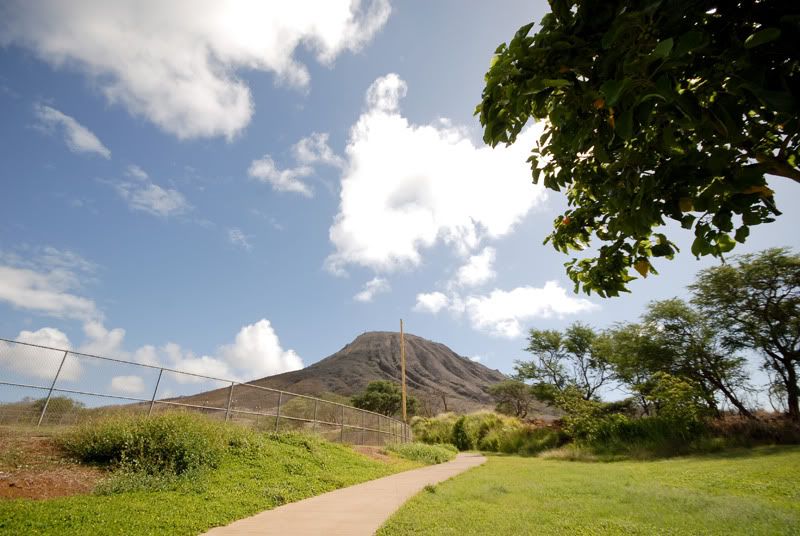
heres the view of Koko crater from the parking lot. what a beautiful day!!

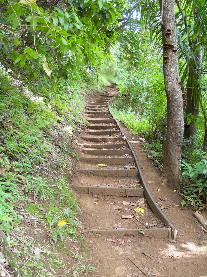
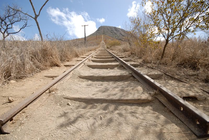
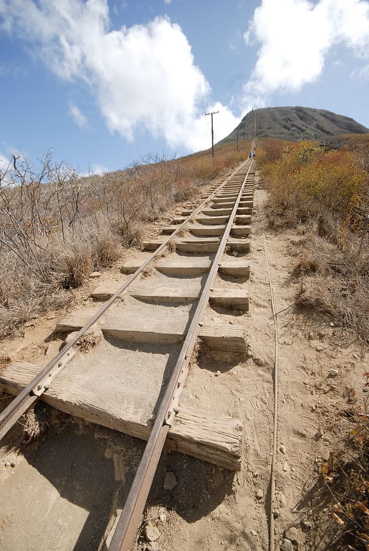
The dreaded stairs!! These things kill me all the time so today i hit 7-11 first for a big gulp!


sure looks like a long way, sure wish had more clouds!!


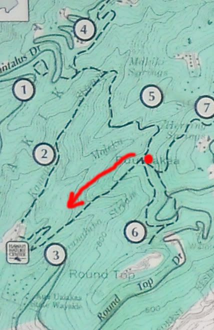
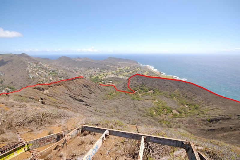
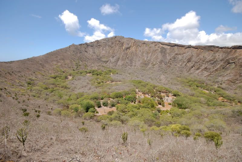
This is my path ill try do today.. yup, around the whole crater!! ive done the east rim once all the way to the golf course but never tried the west rim.

it took me like 35 min to make it up the stairs! or was it 38? it was super hot and dusty and i had no energy! Guess my spam musubi wasnt enuff power!!
 I rested just a bit and asked around if anyone wanted to try the east rim with me but no takers lol


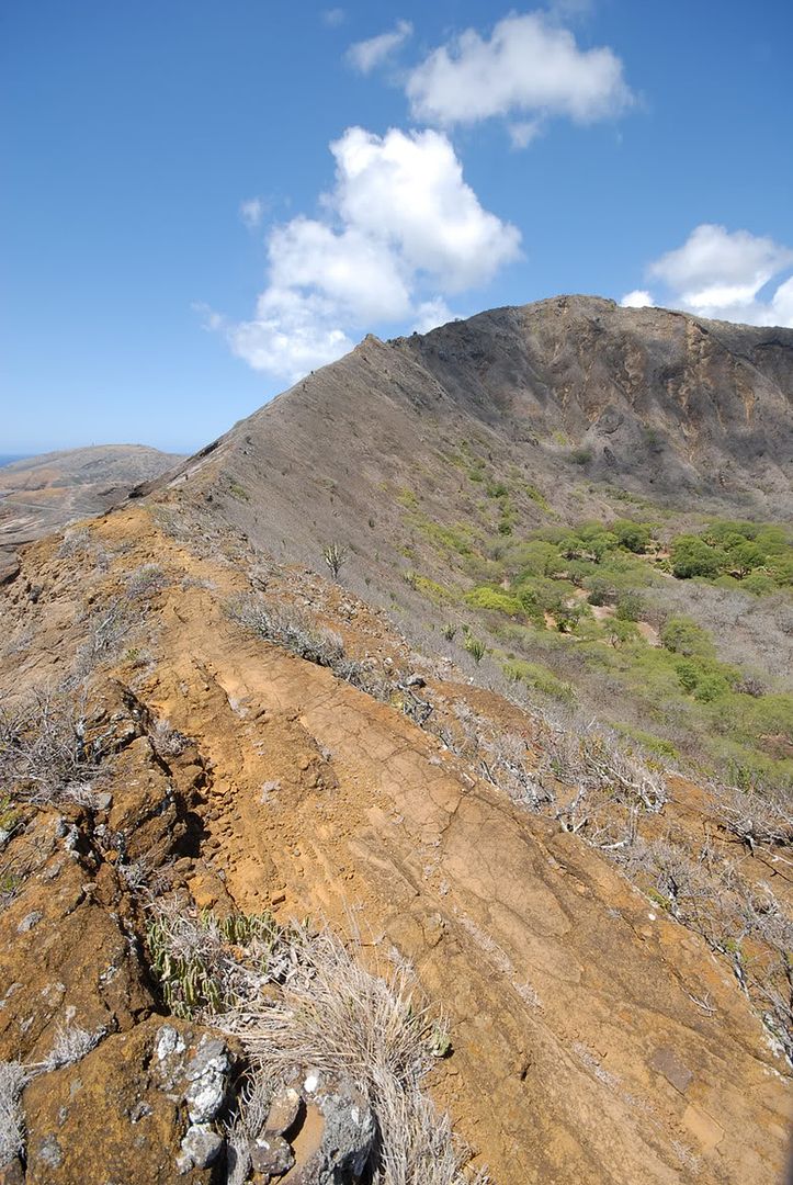
heres a shot looking back towards the bunkers. This part is the only "tuff" part cuz the ground is just loose rocks/dirt so pretty slippery if u not careful.


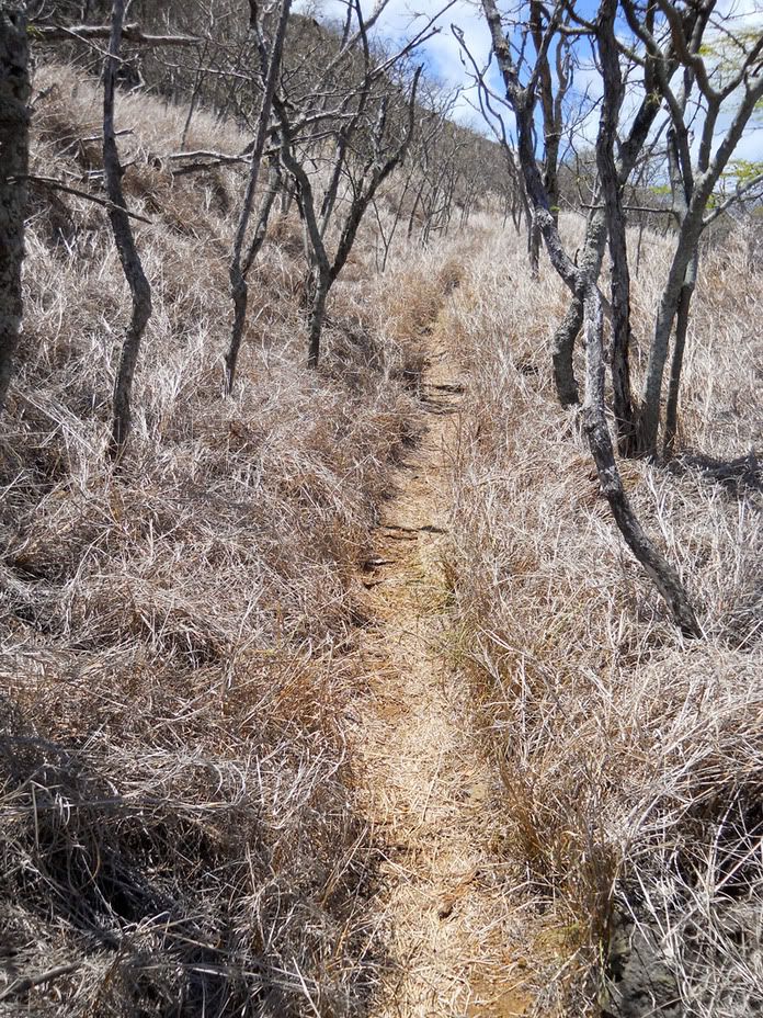
a bit further down the trail. Not hard at all so next time u do the crater, at least hit the east rim.


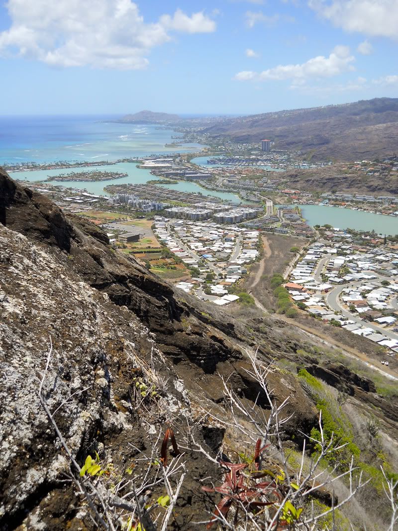
view towards Makapuu. if u look over the rim u get nice birdeye view of blowhole and that curvy road.


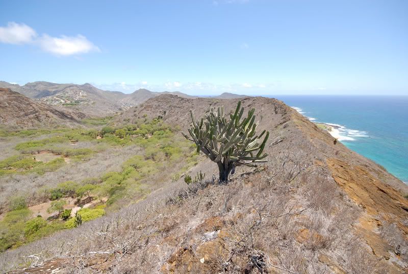
a lonely cactus guards the trail!!


and yes, another view towards the bunkers. Its a pretty long hike, easy but long.


finally a change of pace, there are some rocks u have to walk over/around. nothing scary just great for a change.


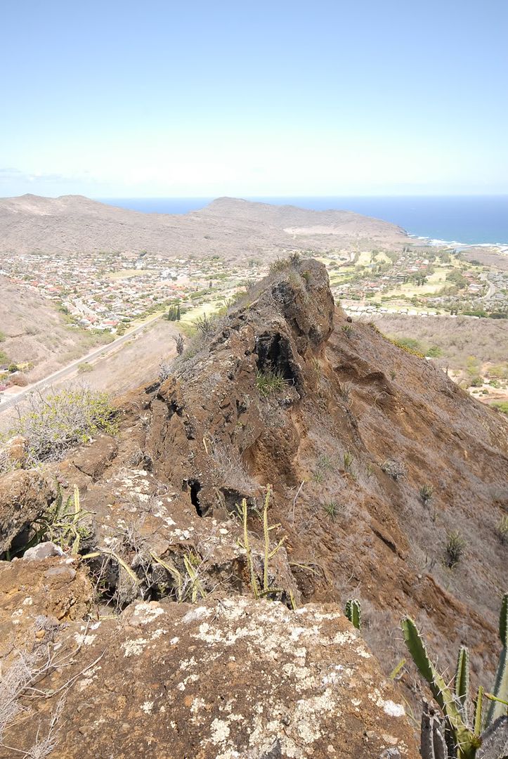
Made it!! this is the opposite side of the crater!! Bet many dont see this view..After this i followed the trail down towards the botanical garden. its kinda steep and kinda slippery but doable


until u reach this part lol. the path was kinda blocked by all the very sharp cactus!


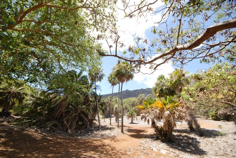
and made it to the gardens!! Since i didnt have much time, i passed on a tour of the gardens. I have a long way to go!!!!


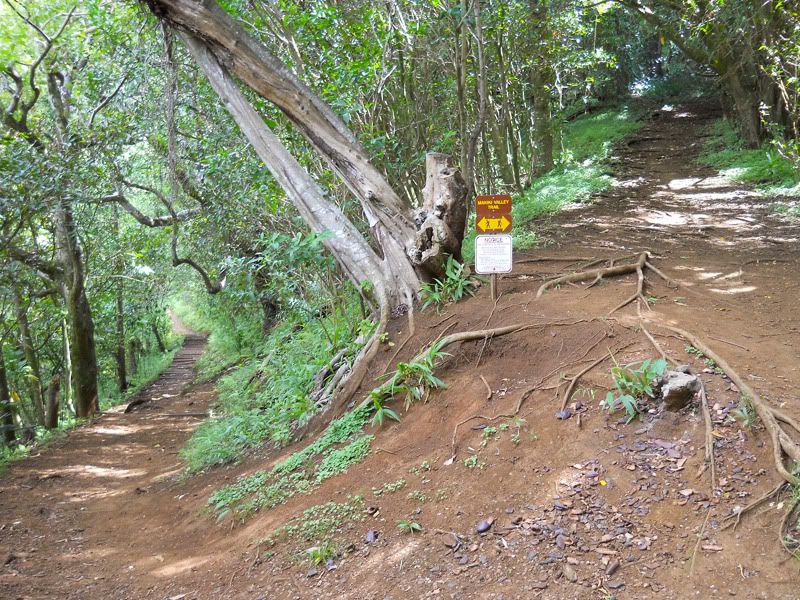
if u follow the road past the plumeria trees it will lead u to the start of the west rim. There is a warning sign saying do go, u will die!!


there isnt much of a trail, just follow the mountain up and i hope u have on jeans, there are plenty of scratchy bushes and thorns to help u along the way.


Heres the start of the climb. u go from here up up and over over lol..


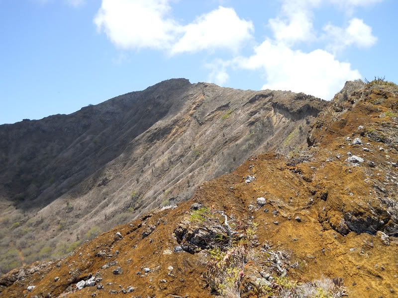
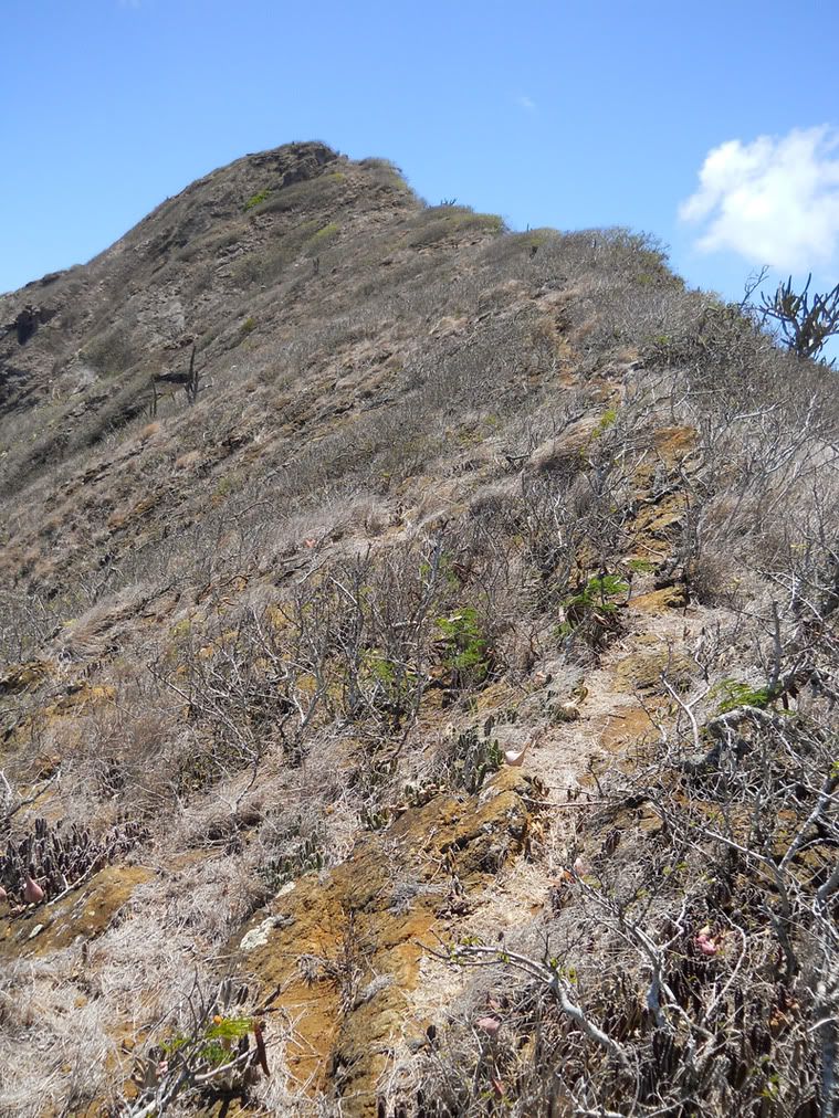
Some parts the trail is really hard to see, so just go where u think it should go and u should be fine. I was gonna use this as my make or break point. if i could make it past these rocks, ill go to top. if too hard/dangerous. id turn back and walk to my car.


I made it!! it was hard cuz i was already getting tired from the long trail ...This is a shot looking back towards Makapuu direction.By this point my water supply was going fast!! I had 4 bottles on my and 2 were drained, one was hot water and my emergency ice cold water(in a small cooler in my pack) was to be used once i made it to the top!!


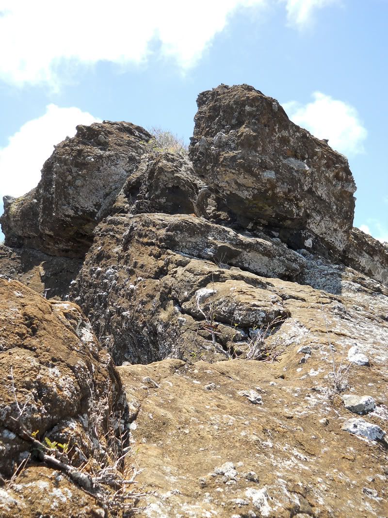
Now its gonna get hard! This was the start of a bunch of rock climbing! Some i went right over only to find the "trail" goes around them!!

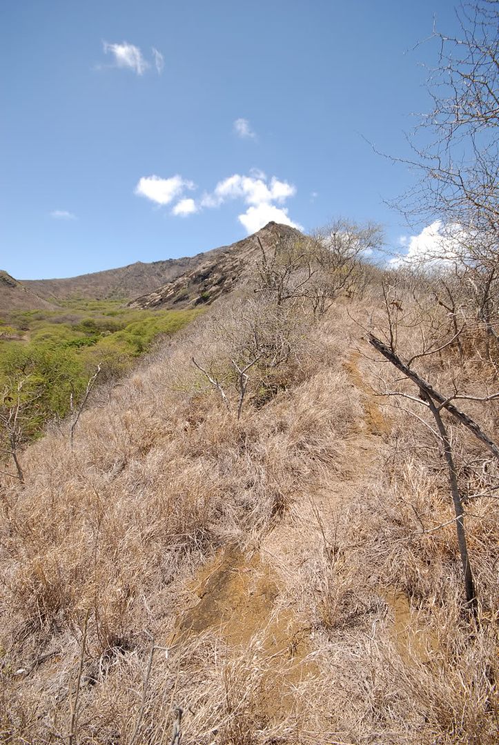
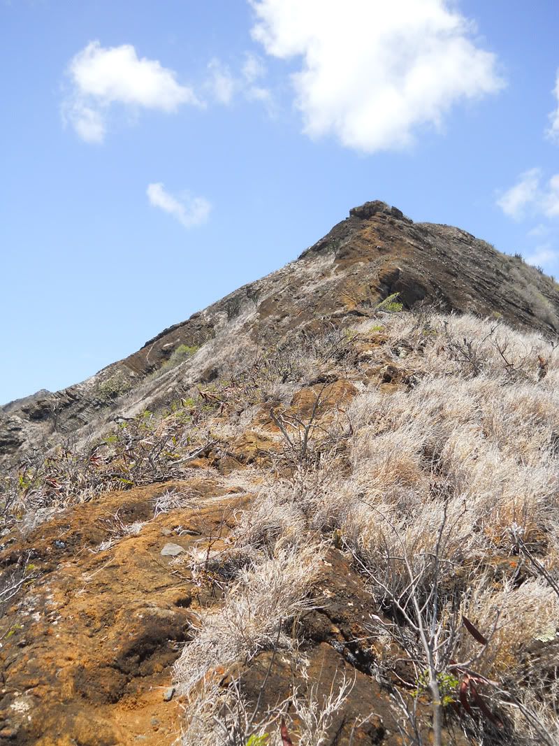
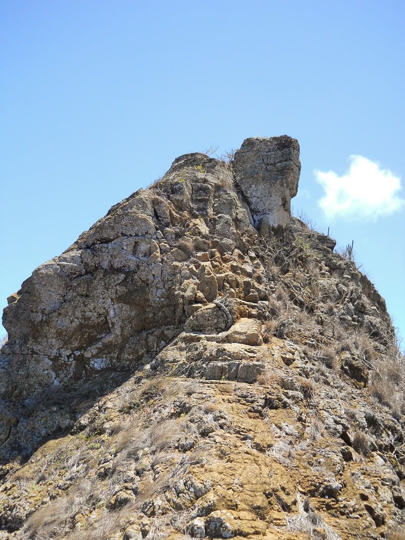
and there's my final goal!! But darn its a long long way and im pooped already lol..

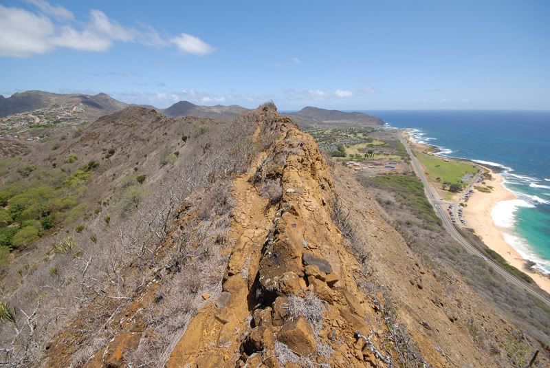
this part got a bit hard/scary. U had to climb over some rocks with nice drops on both sides!! I even had to.... crawl!! haha glad no one saw me !!

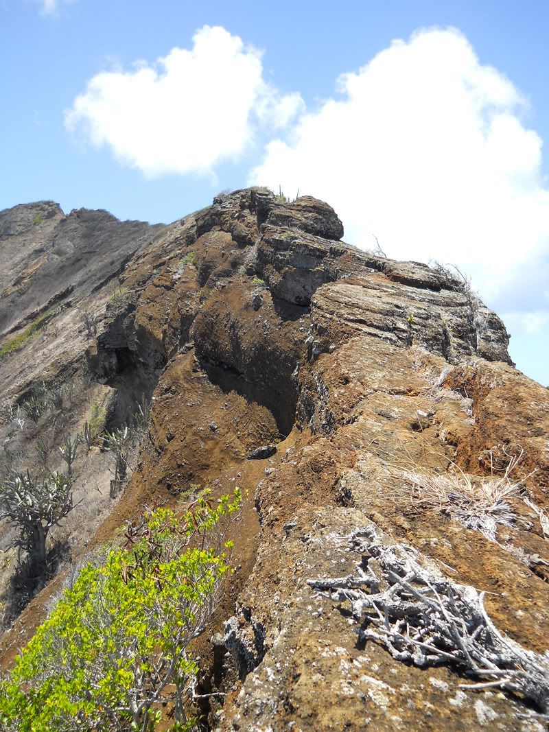
I took a bit of a break to catch a shot towards Diamond head. Theres a nice drop on the right side so make sure u hang on to a sturdy rock! I had a few break off when i stepped on them.

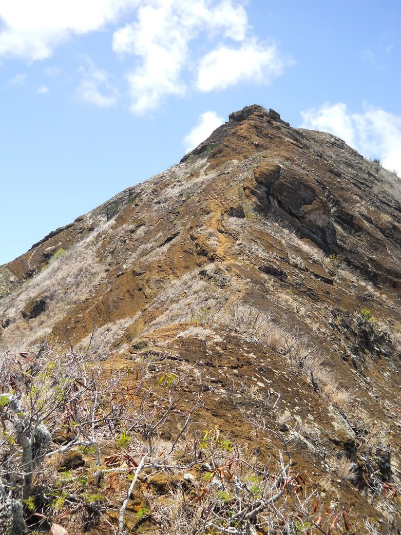
Oh boy, the final sprint to the top! Im almost there! Once u past the rocky part its just flat trail which helped cuz by this time, i knee was sore!! Way to much climbing !!

Who ever made this trail is a cruel person!! after hiking so far u had to climb over THIS at the end!! I was at zero energy ... but, it wasnt that hard haha.
Whole thing took me about 3hours from  bottom of stairs all way round to the bunkers! But by now my poor knee was sore so it took me ..... 40 minutes to get down to my car!!!! But it was worth it!! An awesome hike that was a great change of pace from just walking up those rotten steps.
oo, and if u try, id go counter clockwise like i did. I couldnt even think about going down the west rim!!