I found myself with a free Sunday to do what ever I wanted!! I read about Kulipeamoa hike on the forums a few times and most said advanced hike with some lung busting sections!!
Checked google maps to see the location of the start of trail. End of Anolani rd? Back of Niu Valley? no problems!! Love google maps!
Found me nice parking space right near the trail entrance and off I went..
You follow the road till you see the big water tank building thing. Then, from what I read you just go along the right of the building along the fence to the trailhead.
Cool part is right down that road to the right is a really huge house. What a great place to live! Right up against the forest with no one around. I saw the owner sitting on his patio playing guitar or ukulele.
Here's the fence I was talking about. Must be popular hike since the trail is so well worn.
Just follow the path! No way to get lost as I do on lots of my adventures. It will start to curve to the right since we are aiming to get up on the ridge.
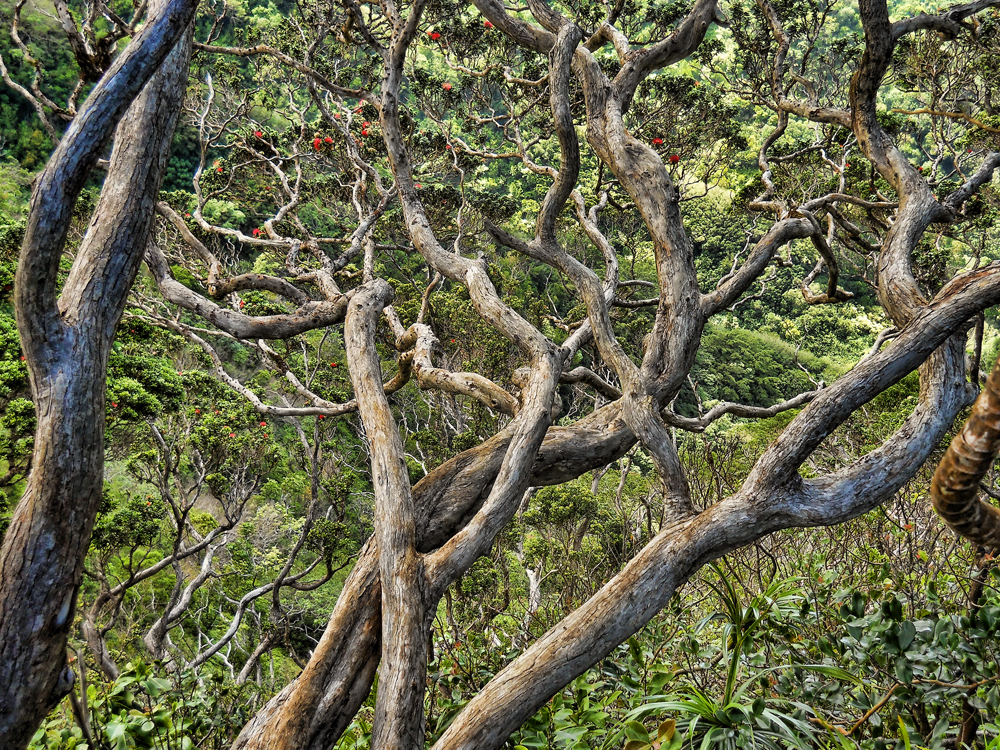
Shot of the ridge that had to be climbed. Didnt look that bad at all but still a nice high ridge!
Guava trees? I hope you like guava trees since this trail (overall) had the most I've ever seen on a hike. And they go back the farthest I've encountered too. Don't get me wrong, I love them since they are super strong! Make great handholds without worrying that they will pull out of the ground.
This shot is about half way up the ridge. I stopped her to grab a geocache along the way.
And almost at the top. By now I could feel the burn!! In my legs that is! The day was nice and sunny but not hot. Picture perfect day for a hike! From the top you are on a ridge trail, like Lanipo so usually your stuck out in the hot sun.
View from top towards the summit. Told you, nice day! Climb so far was about 1 mile in distance with about 1,000 feet in climbing. So, you will get a nice workout just getting here.
Lucky!! Had lots of sections with tree coverage. Trail is still nicely marked and pretty wide. Awesome hike to take beginners on (so far).
Found another geocache along the way. That bug is my geocaching buddy! He's carrying a tiny camera!
Some funky looking plants growing on the ground. I could just picture them waving back and forth like Medusa's hair!
Right here is awesome view towards Hawaii Kai. Nice spot to sit back and relax.
Hmm, summit doesn't look that far away. And the trail doesn't have as many up and downs as most ridge trails.
Some Ohia growing along the way. This trail doesn't have as many native plants as most other trails. Guess all that guava pushed them out.
couldn't pass up a photo oppurtunity! black and white for the win!
Yes, more guava...
Still not getting much higher in elevation. Trail just really takes it's time getting anywhere.
Ah, finally something different! Uluhe ferns to scratch your legs with! There weren't very many of these either. Usually trails are just covered in them the further back you go. And look how nicely marked the trail is!
Trail gets a bit narrow in some parts. And, for a valley ridge trail, this one had the steepest drops I've ever seen! I mean that thing just drops like straight down! And the trail gets really skinny the further back you go. Some parts I swear are like a foot wide.
Almost there! There is only one section near the summit where you have to really climb. See that rope section by the dirt? Thats the fun part! From under it, it goes like straight up! BUT, there is no firm footing, just loose dirt. Luckily someone put a nice new ribbon cable string thing to use as a rope. Usually I don't like trusting ropes when I go hiking since you don't know how old they are. But, with this one, you had to use it since there was almost nothing to grab onto.
 |
| Scary steep part. | Here's close up of the rope section. Think my GPS said it was 100 feet? |
Ugh, couldn't figure out how to get the test to go under that panoramic shot lol..There's another geocache halfway up the hill too. Tough to dig in, open it up, rummage for the logbook, sign it, take picture and try not to slide off!
Another picture towards the ocean. Had nice clouds coming and going to keep it cool. Trade winds were blowing, birds singing...There are a few more hills to get up before you reach the actual summit, but nothing to hard. Just nothing to grab onto since not many trees this high up.
And just my luck! Once I finally reached the summit, the clouds came out and BAM! White out!! I didn't want to waste too much time at the summit since I had long trail to go. I didn't want to go back down the way I came .. yeah, that rope section got me so I headed off to Hawaii Loa Ridge. Checked my GPS and it was only like 1/3 mile away.
Most of the way it was nice but once I got closer, the clouds came back and BAM! Socked in!! The KST between the two ridges was nice and easy. No huge climbs, no scary crumbly sections.
Made it to Hawaii Loa ridge's summit. Finally took a break to eat my lunch. Had few hikers up at the summit but no too friendly and I was too tired to chat lol.
Views were great even with the clouds.
Think I can see Diamond Head way back there.. Lunch went by quickly and it was time to head back to my car. I didnt want to spend too much time since I had no clue where the cut off trail leading back down to Kulipeamoa trail was. All I knew was to look for a chain tied to a tree and few ribbons.
Hmm, think thats Diamond Head....
View of the ridge I climbed up. Doesn't look bad at all.
Found it!! I didn't see the chain on a tree at all but saw a path leading downwards marked by two ribbons! I took GPS reading of the location so next time, you can find it easily. The trail down was just guava, guava, guava and more guava! Not much to take a picture of..
About halfway down there was a clearing and you could see the end of the trail! Looks kinda far....
Right in the middle of the trail, someone built this scary bed!! Think I saw episode of Man vs Wild and he made a bed just like this..
Another neat thing I saw was this really old stone wall right in the middle of the valley. I guess long ago people lived way back here. The wall is pretty long too. Wish knew more of the history of Niu Valley..All I could find is: Niu Valley used to be a dairy farm and back then was considered the “country.”
And finally reached the start of the trail!! Seemed like it took forever but looking at the overall stats, only 4 hours and a half hours to do the loop.
Guess there was a lot of climbing since 3,152 feet total ascent. Not bad at all! No wonder I was so tired!!
And my panos!! Here's one from the top of Hawaii Loa. you can see Olomana and Waimanalo beach. Bit cloudy and I think I over processed the shot. It was really flat pictures since the clouds didnt give much light.
And pano of the ridge from the summit! Nice shot huh?
Overall, fun hike. Bit scary in some parts since I went solo. I think this would be an awesome hike to do with a group. Lots of nice scenery, not that hard till the very end.