Another day off and Im sick of Koko Crater so I decided to do a trail I've never done before. Read about it a few times so I knew where it started.
This shot shows as far as I got on the hike. Almost like the Lanipo trail with a bunch of ups and downs.
Just cross the street and start climbing. There are a bunch of trails leading up the cliff so just pick one that looks like its going in direction you want to go.
Not long hiking and you get awesome views from the top of the ridge. Thats the hardest part of this trail, too many spots to take pictures!!
Nice views of Koko Crater too. Glad I did this hike instead of Koko Crater!
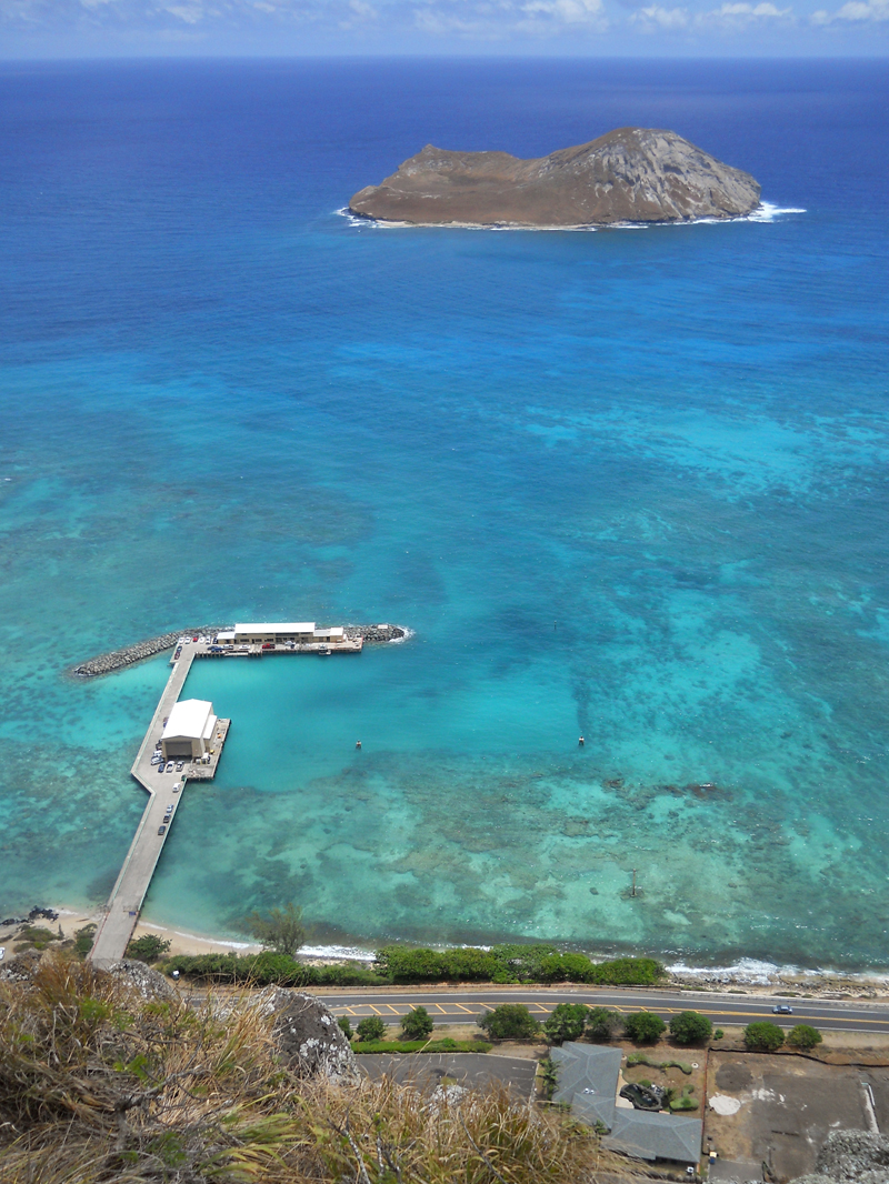
Birds eye view of Sea Life Park. Funny part is from way up here, you can still hear the seals barking/honking.
Another view of the backside of Koko Crater. Again plenty Keawe bushes to watch out for! They got me more then a few times.
Sea Life Park again. I got lucky and it was a beautiful day. Even had a small cloud burst to cool me off.
And again Koko Crater and hmm what valley is that.... So far the trail hasnt been that tough. Few sections where you walk close to the edge but nothing hair raising.. yet.
And finally made it to the puka! If you sit near the hole, there is a nice breeze to cool off with. If you want to turn around at this point, total hike so far: 968 feet in climbing and 1.38 miles distance. I marked this on my gps so if I take a beginner on this hike, its not too hard.
Looking back towards Makapuu shows the puu I just climbed down.
Pretty day to go swimming! No idea what that thing is, looks like a dock for boats but I've never seen any there.
Saw a cave along the trail so I climbed down to it to take a peek... nothing there.
I was going to use this big hill as my stopping point since it looked really steep and would be tough getting back down.
Everybody takes a boot shot to show how far up they are so I gave it a try lol! Still a long way to fall if you make a mistake.
And finally I could see the view towards Kailua/Waimanalo! Still trail is pretty easy even tho you have a lot of ups and downs.
Well, that hill that I thought would be too tough to climb just sorta got passed by w/out much problem. Not many parts you had to "climb" up, most just walk up while holding onto rocks. I forgot to get a picture of the house thats all way on the top of this cliff! What an awesome house!
Top of the puu was a great spot to eat lunch. Nice flat section and by luck, had some light clouds to keep me from frying! only 1270 ' in elevation so about as high as Koko Crater.
Reached what I guess was the older launch pad for hang gliders. Looked kinda scary to step on it.
Finally got a view of Olomana! Not much further on my hike since its gettng late.
And made it to the launch pad. Looks way better then the other one. I just noticed there is a road leading up here! I could have just driven!! j/k
And final view toward Koko Crater but this time you can see Koko Head. Wow, i've really gone pretty far. Didnt seem that far when you're hiking.
Started heading back to Makapuu after grabbing the last geocache on my list. Sad part is when I got home to log them, there was another one just past the launch pad... Saw this friendly hang glider dude sailing above me on my way back. He was doing all kinda scary moves! No way you'd get me up in one of those things!
Going back only part i dreaded was the last big hill to climb! I was still tired from my 2 days in a row going up/down Koko Crater.. But lucky was
only 280'! Felt alot higher when you pooped..
Only had one mishap along the way. Since the trail is mostly lava rocks, there isnt much of a trail to follow, you just look for scratches on the rocks. Going down the last big hill, I took a wrong turn and was heading down a spur that went all way down to the road!! Luckily the hang glider saw me and was giving me directions back to the trail!! Hows that? I had a guardian angel flying above me! Thx hanglider dude!!
And final tally, 4.47 miles (felt alot more) and 2,615' climbing! Took about 4 hours because I was looking for 4 geocaches along the way. I wish I could have gone farther to the Iron wood section and maybe seeing the Tom Tom part of the trail (part that leads to Waimanalo), but mabye next time..


No comments:
Post a Comment